Condition reports
For more complex condition surveys, SRAL uses the Metigo Map software from focus GmbH in Leipzig. This software is used to map out a room or object in its entirety, with damage and previous interventions marked using different colour codes. In addition, this software enables us, for example, to calculate surface areas more effectively and accurately. This allows us to produce well-calculated estimates of the scope of a conservation project.
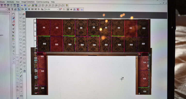
Metigo Map
Metigo MAP is software specially developed for, amongst others, conservators to support the conservation process. It is used for condition surveys, documentation and analysis of both 2D and 3D objects and spaces. It allows photographs of the object or space to be edited in such a way, by vector-based mapping, that all damage and previous interventions are clearly visible. Whilst also enabling calculations to be carried out to prepare for and guide the entire restoration process as precisely as possible. Metigo MAP is used by us on tablets and allows images to be captured and adjusted directly on site, on the object.
Website Metigo Map